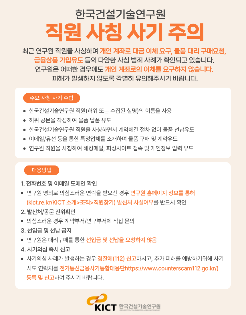
본문 바로가기
KICT 한국건설기술연구원
About KICT
Welcome Message
Mission & Function
History
Personnel & Budget
Social Responsibility
Organization
Staff
KICT CI
Contact
Related Organization
Location
Ilsan HeadQuarters (Main Research Facilities)
Department of Fire Safety Research (Hwaseong)
River Experiment Center (Andong)
Yeoncheon SOC Demonstration Center
Research Division
Department of Highway & Transportation Research
Introduction
Staff
Papers
Department of Structural Engineering Research
Introduction
Staff
Papers
Department of Geotechnical Engineering Research
Introduction
Staff
Papers
Department of Building Research
Introduction
Staff
Papers
Department of Hydro Science and Engineering Research
Introduction
Staff
Papers
Department of Environmental Research
Introduction
Staff
Papers
Department of Future & Smart Construction Research
Introduction
Staff
Papers
Department of Fire Safety Research
Introduction
Staff
Papers
Department of Building Energy Research
Introduction
Staff
Papers
Department of Construction Test & Certification
Introduction
Staff
Papers
Department of Construction Industry Promotion
Introduction
Staff
Papers
Department of Construction Policy Research
Introduction
Staff
Papers
Korea Construction Standards Center
Introduction
Staff
Papers
Research Information
Research Reports
Press Release
Research Facilities
Ilsan HeadQuarters (Main Research Facilities)
Department of Fire Safety Research (Hwaseong)
River Experiment Center (Andong)
SOC Demonstration Research Center (Yeoncheon)
Research videos
Industrial Support
Smart Construction Support Center
Intro
Smart construction startup idea contest
Office and support space for resident companies and support for residents
Open Incubation Program
Smart Construction Innovation Startup Program
Smart Construction Technology Plaza
Intro
Registration Procedure
Review Items
Utilization Strategies
Smart Construction Alliance
Intro
SME Support
Technology Transfer
Accreditation Certification and Testing
Standard of Construction Estimate
International Cooperation
International Activities
International Memorandum of Understanding (MOU)
UST-KICT School
News & Notice
News & Notice
Global KICT
Global Recruiting
Information
Notice
Brochure
PR Film
Newsletter
Lab Tour
직원찾기
페이스북
블로그
KOR
전체메뉴
검색
닫기
About KICT
Research Division
Research Information
Industrial Support
International
Cooperation
News & Notice
About KICT
Welcome Message
Mission & Function
History
Personnel & Budget
Social Responsibility
Organization
Staff
KICT CI
Contact
Related Organization
Location
Ilsan HeadQuarters (Main Research Facilities)
Department of Fire Safety Research (Hwaseong)
River Experiment Center (Andong)
Yeoncheon SOC Demonstration Center
Research Division
Department of Highway & Transportation Research
Introduction
Staff
Papers
Department of Structural Engineering Research
Introduction
Staff
Papers
Department of Geotechnical Engineering Research
Introduction
Staff
Papers
Department of Building Research
Introduction
Staff
Papers
Department of Hydro Science and Engineering Research
Introduction
Staff
Papers
Department of Environmental Research
Introduction
Staff
Papers
Department of Future & Smart Construction Research
Introduction
Staff
Papers
Department of Fire Safety Research
Introduction
Staff
Papers
Department of Building Energy Research
Introduction
Staff
Papers
Department of Construction Test & Certification
Introduction
Staff
Papers
Department of Construction Industry Promotion
Introduction
Staff
Papers
Department of Construction Policy Research
Introduction
Staff
Papers
Korea Construction Standards Center
Introduction
Staff
Papers
Research Information
Research Reports
Press Release
Research Facilities
Ilsan HeadQuarters (Main Research Facilities)
Department of Fire Safety Research (Hwaseong)
River Experiment Center (Andong)
SOC Demonstration Research Center (Yeoncheon)
Research videos
Industrial Support
Smart Construction Support Center
Intro
Smart construction startup idea contest
Office and support space for resident companies and support for residents
Open Incubation Program
Smart Construction Innovation Startup Program
Smart Construction Technology Plaza
Intro
Registration Procedure
Review Items
Utilization Strategies
Smart Construction Alliance
Intro
SME Support
Technology Transfer
Accreditation Certification and Testing
Standard of Construction Estimate
International Cooperation
International Activities
International Memorandum of Understanding (MOU)
UST-KICT School
News & Notice
News & Notice
Global KICT
Global Recruiting
Information
Notice
Brochure
PR Film
Newsletter
Lab Tour
KOR
전체메뉴 닫기
Research Information
Research Reports
Press Release
Research Facilities
Ilsan HeadQuarters (Main Research Facilities)
Department of Fire Safety Research (Hwaseong)
River Experiment Center (Andong)
SOC Demonstration Research Center (Yeoncheon)
Research videos
Research Reports
Home
Research Information
Research Reports
검색
ALL
Subject
Content
Search
TOTAL
44
Current page
1
/
5
Core Solution for the Era of Fully Autonomous Driving: Physical Infrastructure Supporting Autonomy
Senior Researcher Kim Young-min, Department of Highway and Transportation Research, KICT Prologue To operate independently, autonomous vehicles (“AVs” hereinafter) must be capable of perceiving and interpreting their surroundings. In essence, they need to perform the same sequence of actions that human drivers carry out—Perception–Identification–Emotion–Volition (PIEV). To achieve this, AVs must be equipped with systems and performance capabilities that support this sequence. For AVs, the functions that parallel the human PIEV process are recognizing the driving environment and controlling the vehicle based on that recognition. The environment they must process includes not only the fundamental road layout (e.g., horizontal and vertical alignment, lane configuration) but also dynamic, real-time information, such as the presence and movement of other road users (vehicles, pedestrians, etc.) and the traffic regulations governing road use. Up to now, road infrastructure systems have been developed and operated with human drivers as the primary consideration. To achieve the commercialization of fully autonomous driving technology, it is essential to re-examine road infrastructure systems with AVs as the primary consideration. The Korea Institute of Civil Engineering and Building Technology (KICT) has pursued various R&D initiatives around strengthening the role of road infrastructure in the age of autonomous driving (for related content, see the Spring 2025 special feature “Future Road Development for Cooperative Autonomous Driving”). This article introduces the Physical Infrastructure Supporting Autonomous Driving currently being developed at the KICT. Background and Purpose of Technology Development To realize fully autonomous driving—defined as Level 3 or higher under the SAE (Society of Automotive Engineers) standards, where control authority shifts from the human driver to the vehicle—it is essential to combine advanced AI-based environmental perception using onboard sensors with technologies that link static and dynamic information from high-definition road maps, known as the Local Dynamic Map (LDM). Together, these technologies enable vehicles to perceive their surroundings with high-precision positioning. This approach represents the core concept of cooperative autonomous driving, in which infrastructure supports autonomous vehicles in carrying out driving tasks. To make this vision a reality, various forms and methods of infrastructure support have been proposed (see Figure 1). Let us return to the perspective of human driving behavior. The information a driver uses to perform driving is more extensive than commonly assumed, and the cognitive processes involved in decision-making are highly complex. For example, the act of lane changing stems from several decision-making factors and resolutions. This includes decisions such as recognizing that the current lane is more congested than an adjacent lane and deciding to change lanes, determining that the lane ahead is blocked due to construction or other reasons and therefore a forced lane change is unavoidable, or choosing to move into a lane closer to the intended direction in order to make a left or right turn at an intersection. At a deeper level, driving involves collecting “evidence” for each decision, followed by “reasoning” to reach the final judgment. In short, the decision-making process required for driving combines sensory inputs—such as visual recognition of an obstacle’s shape or auditory recognition of a horn—with prior driving experience and accumulated know-how in situational judgment. AVs must carry out the same processes as human drivers. At this point, the role of road facilities—referred to in this article as “physical infrastructure supporting autonomous driving”—is revealed. Because sensor-based perception systems have inherent limitations, AVs are currently required to transfer control authority back to the driver in what are commonly called “handicap situations and zones” (Jeon and Kim, 2021). Representative examples include reduced visibility due to weather conditions such as fog, which makes it difficult for vision sensors to collect information, and lane closures caused by roadwork; these are classified as typical “autonomous driving handicap situations and zones.” If “physical infrastructure supporting autonomous driving” can provide support in such “handicap situations and zones” by contributing to the “decision-making process,” more specifically to the “evidence collection process for decision-making” and to “reasoning using decision evidence,” it can offer practical and meaningful assistance for AV operations. The implementation of “physical infrastructure supporting autonomous driving” can be broadly categorized into two types. The first involves enhancing existing road facilities so that they are more easily detected by AV sensors. In practice, this means improving the sensor-based perception performance of road facilities—while preserving their inherent functions and properties—by accounting for the characteristics of key vehicle sensors used for environmental perception (e.g., cameras, LiDAR). Examples include adjusting the color or material of facilities within existing regulatory limits, or making structural modifications that expand sensor-detectable areas without altering their outward appearance. The second type involves leveraging the physical properties of road facilities to provide the AV with information that can serve as more reliable evidence in its reasoning process. For instance, facilities shaped like conventional traffic signs can display encoded information that AV sensors can detect and interpret, thereby delivering critical road operation data for vehicle control. This approach can be viewed as equipping AVs with functions equivalent to those that road facilities provide for human drivers—such as traffic regulation signs that indicate required actions, or guide signs and safety facilities that offer useful reference information while driving. Development and Verification of Physical Infrastructure Supporting Autonomous Driving: Focus on Lane-Closure Sections In 2024, the research team developed a prototype AV (see Figure 2). Although it is just one of many AVs designed and manufactured in South Korea, this vehicle has a unique function: it enables “vehicle control and autonomous driving through physical infrastructure support.” By incorporating physical infrastructure into vehicle control, the research team compared AV perception performance in “handicap situations and zones,” as well as vehicle behavior with and without infrastructure in those conditions. This made it possible to verify the suitability of the physical infrastructure system for autonomous driving. Every day, countless events unfold on the road. Among them, one of the most critical situations directly affecting vehicle operation is the lane closure. Lane closures often occur due to road maintenance or accident response, and vehicles must detour around the closed lane in order to continue driving. Human drivers recognize and interpret lane closures through multiple cues—for example, visually confirming traffic control devices such as cones or guard barriers, observing hand signals from traffic controllers like police officers or flaggers, or noticing forced merges of preceding vehicles. AVs, however, have clear limitations in carrying out such reasoning and judgment processes. Given that lane closures are highly dynamic and variable on roadways, it is expected that map-based electronic information systems alone will not be sufficient to provide reliable information in these situations. The research team devised a system that enables AVs to more easily recognize lane-closure situations by utilizing “encoded signs” that can be detected through road facilities (see Figure 3). In lane-closure sections, the vehicle must perform lateral control, which consists of two tasks: avoidance control, where the vehicle detours around the closed lane, and return control, where the vehicle decides whether to return to its original lane after passing the closed section, depending on the requirements of the global driving path. To achieve this, the team applied a technology that recognizes point cloud data (PCD) patterns obtained through in-vehicle LiDAR, enabling AVs to detect lane-closure situations via road facilities and incorporate this information into vehicle control. This approach takes advantage of LiDAR’s greater robustness under adverse weather conditions (e.g., heavy rain, fog) compared to vision sensors, thus addressing the “visibility obstruction” handicap situation that cannot be easily resolved by simply improving conventional vision sensor–based perception (Kim et al., 2024). The following are the speed and angular velocity values measured inside the AV when passing through a lane-closure section, both without and with the installation of physical infrastructure supporting autonomous driving. This experiment was conducted by recreating a lane-closure environment at the Yeoncheon SOC Demonstration Center and observing how the vehicle’s behavior differed depending on the presence or absence of physical infrastructure. When the AV recognizes the lane-closure section, lane-change control is performed, during which the vehicle reduces speed to an appropriate level and executes a turning maneuver to change lanes. In this process, if physical infrastructure that provides lane-closure guidance exists, the AV can recognize the lane-closure section in advance. Compared to abrupt maneuvers such as sudden deceleration or sharp turns—often carried out by AVs when facing unexpected physical situations that make normal driving difficult—this advance recognition induces smoother driving. Numerically (see Figure 4), without the use of lane-closure guidance infrastructure, the AV reduced its speed by up to 20 km/h when changing lanes, with angular velocity reaching a maximum of 0.15 rad/s. In contrast, when physical infrastructure was utilized, the AV reduced its speed by only up to 10 km/h to pass through the section, and its maximum angular velocity remained within 0.10 rad/s, confirming quantitatively that more stable driving was achieved. The results of this experiment indicate that the physical infrastructure supporting autonomous driving not only has positive effects on AVs themselves but can also generate even greater benefits in situations where AVs and conventional vehicles coexist. From a traffic flow perspective, large fluctuations in the speed and angular velocity of an individual vehicle make the vehicle a so-called “troublemaker” that disrupts overall traffic stability. The function of physical infrastructure that ensures AVs are controlled so that they do not behave in ways that appear unusual compared to human drivers contributes to improving the stability of mixed traffic flow involving both AVs and conventional vehicles, and is therefore expected to positively influence the broader adoption of AVs. Epilogue As of 2025, many experts believe that autonomous driving technology is currently in a stagnation phase of development and diffusion known as the “Chasm.” In the early 2010s, when Google first unveiled its autonomous vehicle to the public, most countries had set targets for the commercialization of autonomous driving that were earlier than 2020. Today, in the mid-2020s, only a very limited number of production vehicles equipped with autonomous driving functions at SAE Level 3 or higher—a recognized milestone for commercialization—actually exist, and even these are constrained to operating only within various limitations defined by their Operation Design Domain (ODD). This reality implies that there are significant technological challenges that must be solved before we reach the era of fully autonomous vehicles, and at the same time highlights the need for new methodologies and approaches. Various R&D cases conducted thus far demonstrate that cooperation between vehicles and infrastructure is indispensable for the commercialization of fully autonomous driving. The methodology introduced by the research team in this article—namely, constructing an environment in which AVs can more actively utilize road facilities during the driving process and applying this approach to alleviate the difficulties of AV decision-making and control in “handicap situations and zones”—is expected to serve as a core solution that can accelerate the advent of the fully autonomous driving era. References Kim, Young-min; Park, Beom-jin; Kim, Ji-soo (2024). A Study on the Development and Verification of Infrastructure Facilities Supporting AV Positioning Using Mobile LiDAR. Journal of The Korean Society of Intelligent Transport Systems, Vol. 23, No. 6, pp. 203–217. Jeon, Hyun-myung; Kim, Ji-soo (2021). Analysis of Handicap Situations and Their Causes in Autonomous Vehicles through IPA and FGI. Journal of The Korean Society of Intelligent Transport Systems, Vol. 20, No. 3, pp. 34–46. Korea Intelligent Transport Systems Consortium (2024). Stage Report on the Development of a Digital Road and Traffic Infrastructure Convergence Platform Based on Crowdsourcing.
Department of Highway & Transportation Research
Date
2025-09-24
Hit
21
The Current State of Cable Tension Monitoring Technology in Cable-Stayed Bridges
Senior Researcher Park Young-soo, Department of Structural Engineering Research, KICT Prologue The Special Act on the Safety Control and Maintenance of Establishments defines criteria for managing facilities, including bridges, primarily based on their scale and type, and stipulates that special bridges must be monitored and managed through precise measurements. Among these special bridges, the cable-stayed bridge is a representative cable-supported structure, in which the deck is supported by stay cables connected to towers. Cable-stayed bridges offer improved structural efficiency by combining the tensile strength of cables with the bending and compressive strength of towers and decks. They are particularly suited for long spans, but because of their aesthetic appeal, are also increasingly being adopted for shorter spans, resulting in a steady increase in the number of cable-stayed bridges in service. In such cable-supported structures, the cables are critical structural components. Their tension force and damping ratio affect not only the behavior of the cables themselves but also the overall stability of the bridge. As the main span of a cable-stayed bridge becomes longer, the stay cables linking the towers and decks become more susceptible to vibrations induced by wind and traffic loads. Since these essential cables may experience tension loss for various reasons—and such losses can significantly degrade bridge performance, potentially even leading to collapse in extreme cases—effective methods of monitoring cable tension are indispensable. Various methods for monitoring cable tension have been studied and applied. Among them, the vibration-based method estimates tension using vibration data and has the advantages of easier installation and higher cost-effectiveness compared to other methods. As of 2022, approximately 260 cable tensiometers have been installed on cable-supported bridges managed by the Special Bridge Management Center of the Korea Authority of Land & Infrastructure Safety (KALIS), and most of these monitor cable tension by estimating it through vibration-based methods that use acceleration data. Vibration-Based Method The vibration-based method for estimating cable tension involves the following procedure: 1) installing an accelerometer on the exterior of the cable to continuously collect vibration responses (Figure 2, Step #01), 2) transforming the collected responses into power spectral density (PSD) signals in the frequency domain, 3) extracting peak information (fn: peak location, n: peak order) from the transformed PSD signals (Figure 2, Step #02), and 4) deriving a linear regression equation from the extracted peak information (Figure 2, Step #03). Using the intercept b of the regression equation (0.729 in Figure 2, Step #04), together with the cable’s properties—effective length (Leff) and unit weight (w)—the cable tension is then estimated as expressed in Equation (2). Since the excitation conditions of the cable are not constant, the data collected by accelerometers installed on the cable allow for a more stable detection of peak information as the measurement time increases. However, the longer the measurement time, the longer the tension estimation cycle becomes. Therefore, in practice, acceleration measurements are generally taken at a frequency of 100 Hz, with measurement durations of 10 minutes. The collected acceleration data are then transformed into the frequency domain, and peak information (peak position and order) is detected from the transformed frequency spectrum. During the tension estimation process, the critical task of detecting peak information is mainly performed manually. For example, if data are collected in 10-minute intervals over a 24-hour period, this yields 144 data sets. If accelerometers are installed on 8 cables of a single bridge, peak information must then be detected from a total of 1,152 data sets. Because the detection of peaks is carried out primarily by a human operator, the process is labor-intensive and subject to the operator’s subjective judgment, reducing objectivity. An alternative approach to manual detection is to use pre-set conditions. For instance, peaks can be identified by detecting locations where the amplitude exceeds a threshold, or by defining frequency bands where peaks are expected and selecting the highest value within that band. However, peak information may be missing depending on excitation conditions or cable damage. In cases where the natural frequency of the cable coincides with external excitation conditions, resonance may occur, resulting in unusually large peaks in certain frequency ranges. The limitation of methods based on automatic detection of pre-set conditions is that settings must be customized for each cable specification, and changes in spectral characteristics can hinder the accurate detection of peak information. IoT Measurement System with Automatic Peak Detection Algorithm The vibration signals of cable-stayed bridge cables, when transformed into the frequency domain, generate a power spectral density (PSD) that exhibits two distinct characteristics, as shown in Figure 3. First, the peaks in the cable PSD display a periodic pattern occurring at uniform intervals, reflecting the inherent dynamic properties of the cable. While the spacing of these peaks can vary depending on the cable’s specifications (such as material, geometry, and tension) and the overall structural system, periodicity with consistent intervals is a physical feature common to all cable members in cable-stayed bridges. The second characteristic is that the peaks have relatively higher amplitudes compared to surrounding frequency components. This means that, in the PSD, these peaks behave as outliers compared to neighboring values (Jin et al., 2021). To automatically detect such uniform peak intervals, one can apply the Automatic Multiscale-based Peak Detection (AMPD) technique, a biosignal processing method from the field of Biomedical Engineering (BME) (Scholkmanm et al., 2012). AMPD has the advantage of enabling complete automation because it can automatically detect periodically occurring peaks without any pre-configuration. To capture the second characteristic—where peaks appear as outliers compared to surrounding values—a threshold-based outlier detection method can be used in parallel. In this case, the threshold can be set using the Median Absolute Deviation (MAD) method, which is robust to data containing outliers (Rousseeuw et al., 1993). Based on the peak information estimated using these two techniques, the cable tension is calculated. This technology offers several advantages: (1) there is no need for pre-configuration, (2) it has a high robustness against signal variations, and (3) there is a low computational cost. Acceleration data for cable tension monitoring are mainly collected through wired measurement systems. In these systems, the sensors are connected to the data acquisition devices with cables, and the collected data are transmitted to the managing authority for use in tension analysis. Wired measurement systems have the advantage of enabling stable measurements without data loss; however, they involve additional costs due to the need for cabling between sensors and loggers as well as the installation of protective conduits to prevent disconnection, and they are limited in terms of installation locations and the number of sensors that can be deployed. In recent years, various IoT (Internet of Things)-based measurement systems have been developed and applied to facilities. However, most of them, like traditional wired systems, remain at the level of simply collecting and transmitting data. While this offers advantages in terms of installation flexibility and scalability, it does not fully utilize the potential strengths of IoT technology. IoT measurement systems can incorporate diverse algorithms to filter and process raw data before its transmission, rather than sending the raw data itself. This edge computing technology processes data in real time at the sensor terminal or adjacent devices, reducing the burden of transmission to servers and lowering both processing costs and time. By installing the previously described automatic peak detection algorithm on an IoT-based measurement system and applying it to cable-stayed bridge cables, a study was conducted to verify the algorithm’s accuracy, as well as the usability and efficiency of the measurement system. Through this research, the potential of applying IoT measurement systems and edge computing technologies to facility monitoring was confirmed. Epilogue The integration of IoT measurement systems with edge computing makes it possible to move beyond the traditional approach of transmitting large volumes of raw data to servers for collection and analysis, enabling on-site data processing and optimized management. With the advancement of data processing and analysis technologies now embedded into IoT measurement systems, the scope of data utilization in facility maintenance—which was previously limited to raw data transmission—is expected to expand significantly. In addition, with the advent of real-time processing, it is now possible to respond immediately rather than after the fact, making preventive maintenance achievable. This not only helps prevent safety accidents but also is expected to reduce both direct and indirect social costs. References 2024 Road Bridge and Tunnel Status Report. Jin et al. (2021), Fuly automated peak-picking method for an autonomous stay-cable monitoring system in cablestayed bridges, Autom. Constr. Vol. 126. Scholkmanm et al. (2012), An efficient algorithm for automatic peak detection in noisy periodic and quasiperiodic signals, Algorithms, Vol. 5. Rousseeuw et al. (1993), Alternatives to the median absolute deviation, J. Am. Stat. Assoc. Vol. 88
Department of Structural Engineering Research
Date
2025-09-24
Hit
13
AI-Based GPR Data Analysis Technology for Detecting Underground Cavities and Buried Objects
Research Fellow Lee Dae-young, Department of Geotechnical Engineering Research, KICT Prologue In recent years, a series of large-scale ground subsidence accidents have occurred in urban areas such as Seoul. Examples include the sinkhole accident in Myeongil-dong, Gangdong-gu, Seoul, and the underground collapse at the Sinansan Line construction site in Gwangmyeong. Following these incidents, the Seoul Metropolitan Government announced that it would be strengthening safety management against ground subsidence by conducting intensive Ground Penetrating Radar (GPR) surveys in the areas around excavation sites (Seoul City, 2025). Ground Penetrating Radar (GPR) is a geophysical survey method that uses electromagnetic waves to detect underground structures such as sewer pipelines, buried utilities, and cavities. Since the large-scale cavity incident at the Seokchon Underpass in 2014, GPR surveys have been actively applied to investigate subsurface cavities and ground subsidence beneath urban roads. As a non-destructive survey technique, GPR is useful for identifying underground utilities, cavities, and soil structures. However, it has several limitations, including depth restrictions depending on frequency, sensitivity to soil conditions, and difficulties in data interpretation. In addition, GPR analysis relies heavily on expert interpretation, and for high-resolution or 3D surveys, the data processing and interpretation require a significant amount of time, with notable variations in the reliability of the results. To address these issues, research is now underway on AI-based methods for automatically analyzing GPR data. This article introduces the principles of GPR surveys, along with AI-based methods for analyzing GPR data to improve the accuracy of interpretation, shorten analysis time, and enable real-time analysis. Principle of GPR Surveys Ground Penetrating Radar (GPR) is a survey technique that can identify the location and shape of underground structures such as buried pipelines through transmitting electromagnetic waves into the ground and receiving the reflected signals generated at the boundaries of such structures, while considering their different electrical properties (conductivity and permittivity). GPR employs radio waves with frequencies of several tens of MHz or higher, and is mainly used as a non-destructive testing method to investigate relatively shallow targets at depths of approximately 1–3 meters. It is applied to the detection of underground utilities, cavities, tunnel voids, and stratigraphic structures. More recently, GPR surveys have been intensively conducted in areas where ground subsidence is a concern due to aging sewer pipelines, serving as an evaluation method to help prevent ground collapse (Figure 1). In the analysis of GPR survey data, buried pipelines exhibit strong amplitudes and appear in the form of hyperbolae, as shown in Figure 2. While single-channel GPR systems using one transmitter and receiver pair have been mainly used, high-resolution three-dimensional multi-channel GPR systems have recently come into wider application. GPR surveys are effective for targets buried at shallow depths of up to approximately 3 meters, within which range most pipelines are located, but have limitations when it comes to deeper investigations, such as tunnel construction or large-scale excavation sites. GPR Data Using AI Techniques In the context of the Fourth Industrial Revolution, the outstanding performance and popularization of Artificial Intelligence (AI) technologies have further expanded their applicability. The application of AI to GPR analysis has potential to improve the accuracy and efficiency of underground structure detection and reduce interpretation errors. Recently, to address errors and technical challenges that arise during GPR image interpretation, research utilizing deep learning—one of the machine learning techniques widely applied in the field of image processing—has been actively conducted. The AI-based method for analyzing GPR data involves collecting GPR data in B-scan and C-scan formats, performing noise removal and corrections, and then carrying out data labeling. After generating a corrected labeled training dataset, a Convolutional Neural Network (CNN)-based AI algorithm is used for object detection (Girshick, 2014). Through deep learning, the reliability of buried pipeline detection can be significantly enhanced. The Korea Institute of Civil Engineering and Building Technology (KICT) has conducted research on the application of AI to improve the accuracy of GPR surveys for cavity detection in the ground and the investigation of underground obstacles beneath roads, with the aim of preventing ground subsidence. GPR survey data were used to detect buried pipelines and cavities, and high-quality labeled datasets were generated by converting the GPR data into images and removing noise such as clutter. For the detection of underground utilities and cavities, the Faster R-CNN algorithm was applied, and by employing various training techniques, optimal performance for detecting buried pipelines and cavities was achieved. Through this effort, the KICT developed AI algorithms and GPR data analysis technologies capable of detecting underground cavities and buried pipelines. Epilogue With the acceleration of urban development and the resulting increase in large-scale excavation works, as well as the occurrence of urban sinkholes caused by aging infrastructure, the use of GPR surveys for detecting cavities and ground subsidence has become increasingly important. Recently, research has been progressing on the application of AI technologies to advance GPR data analysis. Integrating AI into GPR surveys can reduce data processing time while improving the consistency and accuracy of interpretation results, thereby overcoming the limitations of traditional GPR analysis. AI-based automatic analysis technology also enables the real-time processing of GPR data and reduces interpretation errors, allowing decision-making processes to move more quickly. Ultimately, this technology can play a vital role in preventing ground subsidence accidents and enhancing the safety of underground utilities. References Seoul Metropolitan Government (2025). Special Countermeasures for Strengthening Safety Management Against Ground Subsidence at Large Urban Excavation Sites. Press Release, Road Management Division, Disaster and Safety Office, Seoul Metropolitan Government. Lee, Dae-young (2015). Development of Ground Subsidence Evaluation Methods Caused by Damage to Old Sewer Pipes. Proceedings of the Joint Conference of the Korean Society of Water and Wastewater (KSWW) and the Korean Society on Water Environment (KSWE), Special Session V-1. Lee, Dae-young (2018). Risk Assessment of Sewer Defects and Ground Subsidence Using CCTV and GPR. Journal of the Korean Geosynthetics Society (KGSS), Vol. 17, No. 3, pp. 47–55. Korea Institute of Civil Engineering and Building Technology (2022). Development of Smart QSE-Based Undergrounding Innovation Technology for Overhead Lines and Road Performance Restoration Technology (1/3), Annual Report. Korea Institute of Civil Engineering and Building Technology (2024). Development of Smart QSE-Based Undergrounding Innovation Technology for Overhead Lines and Road Performance Restoration Technology (3/3), Final Report https://ashutoshmakone.medium.com/faster-rcnn502e4a2e1ec6 R. Girshick, J. Donahue, T. Darrell, and J. Malik (2014) “Rich feature hierarchies for accurate object detection and semantic segmentation,” In Proc. CVPR.
Department of Geotechnical Engineering Research
Date
2025-09-24
Hit
26
Development of Fast Prediction Technology for Urban Flood Forecasting
Researcher:Kim Hyung-jun, Senior Researcher, Department of Hydro Science and Engineering Research, KICT Sim Sang-bo, Postdoctoral Researcher, Department of Hydro Science and Engineering Research, KICT Prologue In recent years, climate change has accelerated the temporal concentration and spatial intensification of rainfall, leading to unprecedented flooding events that cause significant damage. During 2020, South Korea experienced prolonged monsoon rains that triggered flood damage across the country, with floods in some regions that exceeded design flood levels, resulting in substantial loss of life and property. 2022 saw localized torrential rainfall in southern Seoul that exceeded the capacity of urban drainage systems, causing widespread inundation throughout the city and resulting in casualties, particularly in the Gwanak-gu area, where many residents live in underground spaces. Such rainfall events exceeding expectations are anticipated to continue increasing. Particularly in urban areas with high ratios of impervious surfaces, the risk of flood damage from localized concentrated rainfall is rising, and this risk is expected to increase further in the future. As a countermeasure, the Ministry of Environment, based on recent cases of large-scale flood damage, is designating additional flood warning points along rivers to expand its flood forecasting coverage, and has enacted new legislation to establish an institutional foundation for implementing flood forecasting in urban areas. The Korea Institute of Civil Engineering and Building Technology (KICT) is developing urban flood forecasting models to support the Ministry of Environment's implementation of urban flood forecasting. Development of Real-Time Urban Flood Prediction Model 1. Dual Drainage Model for Urban Flood Prediction To analyze the urban inundation caused by localized torrential rainfall, it is necessary to use both a 2D model for surface runoff behavior and a 1D model for the flow within complex underground stormwater networks. The traditional method of urban inundation analysis involved first performing 1D stormwater network flow analysis, then calculating the flow discharged from the network, and applying this to a 2D model to assess the extent of surface flooding. However, this approach does not account for the possibility of flow re-entering the stormwater network from the surface, which can lead to overestimating the extent of inundation. Recent advancements have led to the development of a model that dynamically integrates stormwater network flow and surface water flow analysis, allowing for simulations in which excess stormwater flows into the network and causes flooding, and then flows back into the network, helping to resolve the flooding. The Korea Institute of Civil Engineering and Building Technology (KICT) developed the HCSURF (Hyper Connected Solution for Urban Flood) model, which allows for a simultaneous analysis of both surface water flow and stormwater network flow. The stormwater network flow analysis uses the source code of the United States Environmental Protection Agency (EPA)'s SWMM (Storm Water Management Model) version 5.2, while the surface water flow analysis uses self-developed code that discretizes the 2D shallow water equation using the Finite Volume Method (FVM). The SWMM model was written in C, while the surface water model was developed in Fortran. These were integrated into a single project in Visual Studio to allow for information exchange, and compiled into one executable file. The HC-SURF model is designed to analyze urban flooding by sharing the results of stormwater network flow and surface water flow simulations. The calculation of inflows into the stormwater network uses the results from the lumped rainfall-runoff simulation of the SWMM model, which is then sequentially linked to the surface water flow simulation. Alternatively, a distributed rainfall model can be used to perform the surface water simulation, and the inflow to the stormwater network is calculated. After comparing the surface water results, methods for calculating surplus flow and re-entry flow are reflected in the model. 2. Effective Representation of Building Shapes in Urban Areas To perform flood prediction based on rainfall runoff and surface water behavior in urban areas, it is crucial to account for the impact of various structures such as buildings and roads, which significantly affect the flow behavior. Unlike rivers, urban areas introduce additional complexity. Methods for incorporating the effects of buildings into urban flood analysis include: (a) Excluding Building Areas from the Grid: This method excludes building areas from the calculation domain; (b) Reflecting Building Proportions in the Grid: This method calculates the proportion of the grid occupied by buildings, and incorporates this into the governing equations to define the effective area; (c) Applying Modified Roughness Coefficients in Building Areas: This method involves applying higher roughness coefficients to the grids where buildings are present to control flow speed and direction. To develop an efficient numerical analysis model for urban flood forecasting, a study was conducted to examine the differences in results based on various methods of incorporating buildings into the model. The model was applied to an area near Sindaebang Station along the Dorimcheon River, which experienced a large-scale urban flood in 2022, and the results were compared, as shown in Figure 2. Figure 2 (a) shows the results of simulating the inundation range by excluding building areas from the numerical grid. While road shapes are reflected with high accuracy, areas that were not accurately captured during grid generation are excluded from the numerical simulation. This leads to the issue of excluding areas where actual inundation could occur, thus omitting flood-prone areas from the simulation. The results of simulated urban flooding that incorporates the proportion taken up by buildings in the numerical grid are shown in Figure 2 (b). The simulation results demonstrate that regardless of the shape of the grid representing the computational domain, urban flooding is reasonably simulated through roads, and the phenomenon of inundation occurring through roads is captured accurately. In areas with many buildings, the depth of inundation is not calculated, but the simulation can reasonably model urban flooding in grids where there is ample space for stormwater flow. The results of simulating urban flood inundation using modified roughness coefficients are shown in Figure 2 (c). The roughness coefficients were increased in areas with buildings to significantly raise the resistance to stormwater flow, but stormwater still flowed through areas with buildings. As a result, it was observed that, of the three simulation conditions, the urban flood inundation area was the largest under this condition. 3. Achieving Real-Time Forecasting Capability through the Application of Parallel Processing Techniques For urban flood forecasting, it is essential to minimize the simulation execution time in order to improve operational efficiency. The HC-SURF model has been developed to enable real-time urban flood forecasting by enhancing computational efficiency through the application of parallel processing techniques. Table 1 shows the computational time required by applying parallel processing techniques under each condition. When generating the numerical grid that incorporates building shapes, even though parallel processing techniques were applied, the computational time interval is determined by very small calculation grids. As a result, despite the reduction in time, longer computation times are required compared to other methods. In numerical simulations that incorporate the effects of buildings using uniform calculation grids, it was observed that not only is the time reduction ratio higher, but the computational time is also significantly shorter. Advancing Operationalization Through Pilot Testing Korea’s Ministry of Environment enacted the "Act on Flood Damage Prevention in Urban River Basins" after the large-scale urban flood that occurred in the Dorimcheon River basin in 2022, which established an institutional foundation for expanding the flood forecasting areas. Following this, a technology was developed to provide scenario-based urban flood maps for the Dorimcheon River to relevant agencies. However, there are still significant technical limitations when it comes to providing accurate urban flood information by reflecting real-time hydrological data. From its early development stages, the HC-SURF model was designed to support urban flood forecasting for the Ministry of Environment (ME), and this achieved basic performance through three years of research and development from 2022 to 2024. Starting in 2025, pilot testing will be conducted on the operational server of the Ministry of Environment (ME) Han River Flood Control Office (HRFCO) as part of the "Dam-River Digital Twin" project. In March, a real-time linkage system with the Ministry of Environment (ME) hydrological survey database will be established to enhance the model for collaborative support. During the remaining two years of the research and development period, the HC-SURF model will be further advanced to reflect the feedback of the Ministry of Environment (ME), which is the end user, and it is expected that the framework will be established to implement urban flood forecasting as a unique technology in Korea.
Department of Hydro Science and Engineering Research
Date
2025-06-23
Hit
262
Research Directions for Smart Road Infrastructure for Future Mobility
Researcher:Ryu Seung-ki, Senior Research Fellow, Department of Highway & Transportation Research, KICT Prologue Currently, South Korea’s road infrastructure is suffering due to traffic congestion, environmental pollution, and various traffic accidents, all of which are the result of an imbalance between regional traffic demand and road supply. In addition, the roads are aging, and due to climate change, the rate of road deterioration is accelerating. With increasing socio-economic damages caused by these factors, it is clear that “smart” roads are needed to extend the service life of roads and maintain normalcy, and innovative research and development to realize this must be pursued. Smart roads are envisioned as future roads that can assess their current state based on past and present data and predict future conditions to proactively and quickly restore road abnormalities. Roads, being public goods, are spaces where risks will always exist, and thus substantial finance must be allocated for their maintenance and recovery to ensure their permanence and resilience. We must continue the efforts to supply smart road technologies by researching and developing optimal solutions. Smart roads can be realized by improving mobility for various modes of transportation, such as automobiles, railways, Urban Air Mobility (UAM), subways, and buses, enhancing connectivity between these modes, and introducing innovative transportation systems. The core technologies in realizing smart roads involve traditional road and transportation technologies, along with ICT convergence technologies such as AI, IoT, big data analytics, and V2X, with recent advancements in AI technology and its wide-ranging applicability making it an essential strategic technology for smart roads. Smart roads must focus on the development of core technologies for future mobility across the entire process, from planning and construction to maintenance. In the planning and construction stages, calculating, analyzing, and predicting materials, time, and costs can help manage resources efficiently while also saving costs. In the construction and maintenance stages, smart road technologies will play a critical role in quality and safety management. Future infrastructure research and development policies for roads must introduce more innovative research programs and government policies to address current traffic issues and respond to upcoming changes in future mobility. The Korea Institute of Civil Engineering and Building Technology (KICT) is engaged in research and development in the field of core technologies for future transportation infrastructure, with the Department of Highway and Transportation Research playing a central role. Research Directions and Achievements in Smart Road Infrastructure From 2021 to 2024, the Department of Highway and Transportation Research has been focused on developing core technologies for smart road infrastructure for future mobility. The key research areas have been set as future mobility, sustainable and eco-friendly roads, international and regional cooperation, and the construction of future road demonstration infrastructure. Notably, the future mobility sector has been focused on developing autonomous cooperative driving infrastructure and service technologies, with research and development centered around road infrastructure. In 2021, the first year of the Department of Highway and Transportation Research, research planning focused on road facility safety, digital transition services, traffic signal systems, active road icing accident reduction, wireless charging energy road infrastructure, smart mobility MaaS (Mobility as a Service), and AR-based vehicle location recognition technologies. In 2022, representative and seed projects were actively conducted. Research and development were focused on technologies for safe future roads, road infrastructure for autonomous driving safety, and driver assistance technologies based on vehicle video recorders. At the same time, tasks were planned for intelligent road safety management systems and public transportation infrastructure service diagnosis technologies, in response to policy demands. In 2023, the department continued to support representative projects and initiated planning for tasks such as digital twin services for road risk management, smart parking platforms, and vehicle tire data-based road information services. In 2024, new core projects were launched, including AI Safe Road technology for next-generation neighborhood environments and plastic road infrastructure technology for autonomous driving. Seed projects such as video-based road risk element detection technology, parking lot digital transition technology, and road traffic noise model design were also pursued. While much research and development have been conducted for high-spec trunk roads such as highways and national roads, research and development on local roads, narrow roads, and mixed-use pedestrian and vehicle roads have been relatively scarce. Moreover, the ultimate goal of future mobility will be a safe last-mile autonomous driving service. Smart road infrastructure for future mobility can be realized through a variety of core technologies, and we are proactively researching these to ensure their integration into follow-up projects, practical application, and responsiveness to policy demands. In particular, increasing the utilization of artificial intelligence (AI) is crucial. To achieve this, we are developing various AI applications and core technologies that integrate AI into existing road systems. Summarizing the achievements of the Headquarters Purpose-Specific R&R projects carried out from 2021 to 2024, the Purpose-Specific R&R projects played a pivotal role in paving the way for large follow-up projects, yielding excellent results. Over the three years, 12 subprojects under the Purpose-Specific R&R initiative were connected to 17 follow-up projects, ensuring continuous research and development. Achievements in the Development of AI-Based Road Infrastructure Application Services for Future Mobility In the course of the Purpose-Specific R&R projects, we would like to introduce the AI application mobility service technology for smart road infrastructure, which we have secured as part of future mobility. First, we present a solution to accidents related to road potholes, which have been repeatedly identified as high-risk objects on the road. Autonomous vehicles continue to face challenges in detecting high-risk objects such as potholes using visual recognition. Solutions for detecting such difficult objects require highly reliable detection performance. We have developed the first domestic AI-based road pothole detection solution using black box video footage, and through ongoing research and development to enhance object detection performance under limited perception conditions, are striving to create the world's highest-performing solution. If an AI application solution is secured that can achieve a high level of performance in detecting and recognizing high-risk objects and perception limitations on the road, smart road infrastructure will be able to automatically identify damages such as cracks, subsidence, and potholes on the road. This will lead to efficient maintenance, and transform the infrastructure into a future mobility system that collaborates with autonomous vehicles. Next, residential area roads involve various dynamic objects moving simultaneously, such as pedestrians, vehicles, and motorcycles. These situations will pose a challenge for fully autonomous driving services. Therefore, a solution is needed that enables the smart road infrastructure to recognize these dynamic objects and collaborate with autonomous vehicles. We have proactively developed a multi-object classification solution for narrow roads with a mix of dynamic objects. This solution allows smart road infrastructure to autonomously detect the presence of dynamic objects, their movement trajectories, and parked objects, while also classifying them. Narrow roads, such as alleys, are often obstructed by illegally parked vehicles or other obstacles, making it difficult to assess potential blockages or inaccessible routes for emergency vehicles like fire trucks and ambulances. This can lead to a failure to achieve the critical "golden time" needed to reach the destination, thus increasing the risk of damage. We have developed a smart road infrastructure solution that predicts the effective lane width or accessible routes for narrow roads to secure the golden time. This solution can be applied to video-based traffic accident risk prediction and information provision services. It detects the boundaries of various objects on narrow roads and excludes the objects occupying the road surface to calculate the actual effective road area. By calculating the effective lane width frame by frame, this solution can provide real-time information to emergency vehicles and administrative authorities. For fully autonomous driving, it is essential to secure traffic signal detection and classification technology based on vehicle-mounted cameras. Autonomous vehicles must detect traffic signals ahead and recognize their signal states using visual sensors. To ensure the highest level of autonomous driving safety, fully autonomous vehicles need to use image sensor data to accurately detect traffic signal objects and classify them by type. However, there are still significant challenges in detecting traffic signals when the signal object is small relative to the background or when the contrast with the background is low. We are developing a solution to address these difficult-to-detect recognition issues and improve performance in challenging situations. Research and Development Policies on AI in the US and China The United States recognizes artificial intelligence (AI) technology as a strategic technology directly linked to national security, and is promoting related policies. Under the Biden administration, executive orders were issued at the federal level to develop and spread trustworthy AI, while strengthening international cooperation in response to the emerging potential risks of AI. The policy to ensure the safety and reliability of AI as a national security technology is expected to continue during the Trump 2.0 era under the National AI Initiative Act (2020). Korea must prepare an AI strategy to respond to the Trump 2.0 era. US initiatives in this period can be expected to focus on emphasizing the safety and reliability of AI technology, while maintaining US global leadership through the reinforcement of export controls and technology management related to national security. In response, Korea needs to adopt a balanced policy that proactively addresses global regulatory environments while aligning with the US-led competitive framework for AI technology development and industrial promotion. Strengthening technological alliances with the US and ensuring the ethical use and reliability of AI technology while harmonizing with international regulations is essential. In addition, domestic policies such as the "BASIC ACT ON AI" must be designed to align with global standards, supporting the international expansion of domestic companies and minimizing the impact of the US's export controls and strengthened technology management. At the same time, to secure independent competitiveness in AI technology, it is crucial to increase national investment in research and development (R&D), strengthen global cooperation networks, and foster a comprehensive strategy to support the domestic startup and corporate ecosystem. According to the draft of the 2024 budget report submitted to the Annual Session of the National People’s Congress, China has allocated 371 billion yuan for scientific and technological R&D, with 98 billion yuan (approximately KRW 18 trillion) specifically earmarked for basic science research in fields like physics and chemistry. The Chinese government is emphasizing a "scientific and technological revolution" and is focusing on the development of technologies such as the 72-qubit superconducting quantum computer, hydrogen energy, commercial aerospace technology, robotics, and artificial intelligence (AI). Amid escalating tensions as the US restricts China’s access to key technologies like semiconductors, AI, and quantum computing, China appears determined to avoid falling behind in the global power struggle by expanding its investment in science and technology. Furthermore, China believes that "high-quality development" is a prerequisite to achieving stable growth, viewing independent and innovative science and technology as a driving force of national growth. Recently, China’s AI company DeepThink gained attention by achieving results comparable to OpenAI's models. As scientific and technological innovation is the foundation for the growth of major powers, we must review and adjust our research and development directions accordingly. Epilogue The research and development of smart road infrastructure for future mobility should focus on integrating autonomous vehicles with smart roads, advanced road safety services, and AI-powered smart roads. Core technologies for smart road infrastructure require policy enhancements such as data sharing, standardization, and the expansion of the data application industry to improve efficiency and safety. The Department of Highway and Transportation Research should concentrate on developing core technologies for smart road infrastructure that collaborate with future mobility. This requires the building of data-driven analytical capabilities specific to road traffic, which in turn will help develop internal capabilities for utilizing road traffic infrastructure-based AI technologies, enabling long-term growth and adaptation to government policy changes. Furthermore, to strengthen global competitiveness, it is essential to engage in international cooperation projects and collaborative research initiatives, as well as to expand proof-of-concept research on societal issues by utilizing real-scale smart road infrastructure test beds. In the future, smart road infrastructure will enhance mobility, accessibility, convenience, and safety through cooperative operation between smart roads and autonomous vehicles. To effectively respond to the emergence of future mobility, it is crucial to continuously develop and prepare core technologies for smart road infrastructure. References Ryu Seung-ki et al. (2024) Development of Core Technologies for Future Smart Transportation Infrastructure, Korea Institute of Civil Engineering and Building Technology (KICT) Lee Hae-soo & Yoo Jae-hong (2025) Current Status and Implications of U.S. Artificial Intelligence (AI) Safety and Reliability Policies, Software Policy & Research Institute (SPRi)
Department of Highway & Transportation Research
Date
2025-06-23
Hit
390
Development of Sustainable Construction and Environmental Infrastructure Technology Using Renewable Biomass
Researcher:Ahn Chang-hyuk, Senior Researcher, Department of Environmental Research, KICT Prologue Humanity’s rapid resource utilization and infrastructure development that began in the 20th century has caused a dramatic increase in materials consumption worldwide. Since the 20th century, the mass of infrastructure elements (concrete, asphalt, metals, etc.) and facilities that constitute anthropogenic or human-made products such as buildings, roads, and machinery has increased rapidly. While this has improved user convenience, it has raised potential problems in terms of the sustainability of the construction environment. Biomass shows differences in scope and meaning depending on perspective. From an ecological standpoint, it mainly refers to the total existing amount of biological organisms, including plants that synthesize organic matter using solar energy and the animals and microorganisms that feed on them. However, from a more general perspective including industry, it has a broader meaning regardless of the life or death status or form of organisms, considering energy and renewable resource utilization aspects (e.g., organic waste, sewage sludge, biogas, charcoal, etc.). According to recent research published in Nature (Elhacham et al., 2020), the mass of anthropogenic products and their waste reached the level of the dry mass of ecological biomass existing on Earth between 2013-2020, and is predicted to surpass the wet mass level between 2031-2037 (Figure 1). When applied to "Warming stripes (Ed Hawkins, 2018)," which depicts the annual average global temperature (1850-2018, World Meteorological Organization data) reported to the World Meteorological Organization (WMO), it can be estimated that the rapid increase in global material consumption may have a significant impact on global climate change (Figure 2). Sustainability Strategy for the Domestic Construction Environment According to the 2025 Ministry of Environment (ME) work plan, responding to the climate crisis is the top priority issue affecting public safety and the economy. More specifically, addressing abnormal climate patterns, managing greenhouse gases, and securing international competitiveness in global carbon markets are identified as key sub-initiatives. With the European Union (EU) advancing carbon trade regulations, the continued strengthening of international carbon regulations is expected, and the increase in the global green market size (7.2 trillion USD as of Q1 2024) predicts an inevitable expansion of technology demands related to ESG disclosures, resource security, and circular economy. This signals a paradigm shift in both domestic and international construction environments. Additionally, the implementation of the "Act on Promotion of Transition to Circular Economy and Society" and the "Regulatory Sandbox" is expected to provide regulatory exemptions to strengthen the foundation for the circular use of waste resources in the domestic biomass sector. These efforts aim to achieve the 2035 Nationally Determined Contribution (NDC) targets for greenhouse gas reductions in response to the United Nations Framework Convention on Climate Change (UNFCCC). The detailed steps include preparing conditions for local carbon neutrality implementation through future legislation. In this context, academic studies related to the construction environment are increasingly focused on quantitatively evaluating and monitoring material flows, including resource use and socio-economic metabolism in construction environments, both domestically and globally. By comparing biomass totals and utilizing them, it becomes possible to predict the mass, composition, inputs, and outputs of material stocks and plan for overall resource management. Ultimately, the improvement of recycled biomass or the securing of new uses through scientific and technological processes will offer new perspectives on various environmental problems that were previously unsolvable, contributing to sustainable development. Environmental Issues in Construction Infrastructure and Solutions for Utilizing Recycled Biomass The increasing presence and exposure to potentially harmful anthropogenic contaminants due to urbanization is an important environmental issue that appears in proportion to construction environmental infrastructure development. This represents a persistent global problem requiring innovative solutions (Akhtar et al., 2021). Anthropogenic contaminants typically addressed in urbanized areas include various substances such as heavy metals, hydrophobic organic contaminants, dyes, pesticides, and microorganisms and viruses. Over the past several decades, various environmental technologies have been developed to remove harmful contaminants originating from urban areas. However, these have primarily consisted of limited technological elements for capturing, transporting, and removing contaminants in ex-situ environmental facilities. Nevertheless, the linear management of materials and component technologies, including process complexity, distributed management, customized field application, and cost-effectiveness issues, is recognized as one of the limitations faced by such systems. Conversely, strategies that improve or modify renewable biomass and reconfigure it into in-situ purification systems may be effective approaches that can induce a paradigm shift to adopting sustainable manufacturing practices. Strategies that integrate renewable biomass into environmental management have the advantage of simultaneously achieving resource circulation and environmental pollution management goals by implementing green infrastructure, utilizing renewable energy for energy efficiency and waste treatment, and promoting circular economy principles. As one example, modification of specific chemical structures (e.g., humic-like substances) on material surfaces through cooperation between renewable biomass and microorganisms can lead to the removal of anthropogenic contaminants through various physicochemical mechanisms (adsorption, precipitation, ion exchange, etc.). If these possibilities are realized, we not only can effectively remove harmful contaminants from various environmental media with a new perspective on the renewable biomass that we previously abandoned, but also can provide economic alternatives to landfills, incineration, or purification systems for waste treatment. Therefore, future research directions need to consider strategies that can appropriately utilize renewable biomass and maximize physicochemical properties for environmental purification to effectively limit the behavior of contaminants that may occur in cities. Future Directions for Renewable Biomass Utilization Technologies The application and expansion of renewable biomass utilization technologies not only require the development of alternative component technologies for existing fields but also demand comprehensive systematic approaches. It is necessary to consider the behavioral characteristics and pathways of contaminants occurring in natural and human environments, as well as the risks and environmental impacts on receptors of different contaminant types. To respond to expanding urbanization, nature-based solutions or ecological engineering approaches need to be considered, and industrial ecological life cycle assessment techniques that consider virtuous cycles of material circulation incorporating circular economy elements should be reviewed. In addition, applied engineering attempts through convergent approaches of traditional science and engineering are considered foundational academic approaches in related research. As explained earlier, since the scope of biomass is very broad, methodologies and products that process and modify various organic and inorganic materials in hybrid forms can be expected to achieve sustainable commercialization in the construction and environmental sectors. We anticipate future-oriented technological development that can contribute to the construction and environmental sectors by actively utilizing related approaches. References Akhtar, N., Ishak, M.I.S., Bhawani, S.A., Umar, K. (2021) Various natural and anthropogenic factors responsible for water quality degradation: a review. Water, 13, 2660. pp. 1-35. Ed Hawkins (2018) https://en.wikipedia.org /wiki/Warming_stripes. Elhacham, E., Ben-Uri, L., Grozovski, J., Bar-On, Y.M., Milo, R. (2020) Global human-made mass exceeds all living biomass. Nature, 588, pp. 442-454.
Department of Environmental Research
Date
2025-06-23
Hit
115
AI Agents for Construction Sites: AI Service Implementation Cases and Future Directions
Researcher: Won Ji-sun, Senior Researcher, Department of Future & Smart Construction Research, KICT Prologue What are the technology trends to watch in the AI market in 2025? Global companies including NVIDIA and Microsoft are unanimously pointing to "AI Agents." An AI agent is an intelligent system that perceives its surrounding environment and autonomously makes decisions to take action (Heo Jung-joon, 2024). In simple terms, it is an AI partner that independently makes judgments and achieves given goals without human intervention. It is expected that the era of AI Agents in the construction industry will soon arrive. In the future, we will manage construction sites in collaboration with "AI supervisor agents." What kind of abilities will these AI supervisor agents have? AI Agent Advancement Stages Just as autonomous driving technology can be divided into multiple stages that led to fully autonomous driving, AI agent technology is also categorized into several stages toward artificial general intelligence (AGI). Academic and industry sectors define the development stages of AI agents from various perspectives. According to one AI platform company, AGI will be implemented not as a single large model but as a collaborative form of hundreds of AI agents. The development process of AI agents can be divided into the following four stages (Jaeman An, 2024). Stage 1 is an AI service stage utilizing AI models that handle specific tasks. Stage 2 is an AI pipeline stage, in which AI agents combine multiple AI models to automate workflows. Stage 3 is the specialized AI system stage, which combines multiple AI pipelines within specific domains to solve complex problems. Stage 4 is the general-purpose AI system stage, in which hundreds of specialized AI systems capable of working across multiple domains are integrated. Each stage is expected to develop toward solving increasingly complex problems by utilizing and building upon the technologies of previous stages. Current AI technology is focused on building AI services using specific task models and early pipeline stages that combine them. This article introduces three task models specialized in analyzing civil complaints at road construction sites and an AI service prototype utilizing them, while presenting advancement strategies for progressing to the next stage. AI Agent Stage 1 Implementation Case - Road Construction Site Official Document-Based AI Civil Complaint Analysis Service The Korea Institute of Civil Engineering and Building Technology (KICT) is discovering AI services to prepare for the AI transformation era and secure data-driven construction project management technology. A survey of 50 construction workers regarding AI needs at construction sites revealed a high demand for the introduction of AI in risk management tasks that are difficult to predict and where experience is lacking, with particularly high demand for responses to civil complaints regarding construction sites. Accordingly, we introduce an AI service prototype developed to solve information utilization problems occurring in the civil complaint response process at construction sites. Official documents in the Ministry of Land, Infrastructure and Transport (MOLIT) Construction Project Management System reveal that there are more than 5,000 cases of civil complaints regarding general national road construction sites annually. To develop field demand-based AI services, interviews with supervision teams (7 people) and surveys (30 people) were conducted to identify problems and requirements in civil complaint work performance, to identify the functions necessary for problem solving. Through a priority evaluation of the derived functions, functions with high work importance that could be quickly implemented using available civil complaint data were selected (Shin Jae-young, Won Ji-seon, 2024). Among all functions, the functions that could improve the efficiency of civil complaint data analysis through AI introduction were selected. An analysis of civil complaint data characteristics determined that applying AI models to the tasks of automatically classifying 20 types of road civil complaints from vast official document data and rapidly extracting key items including complaint causes, requirements, and related facilities would be effective. Accordingly, a "Civil Complaint Type Classification Model," "Civil Complaint Cause/Requirement Recognition Model," and "Facility Recognition Model" were developed for civil complaint analysis automation. To build AI models handling three tasks, supervision team official documents and attachments accumulated over seven years were collected, and a total of 37,926 raw datasets were secured through preprocessing, including text parsing and stop word removal. Optimized models were developed by establishing task-specific labeling standards and data augmentation standards to build training datasets, and then fine-tuning the pre-trained model "KoELECTRA-BASE-v3" using transfer learning methods. The three task models specialized in civil complaint analysis were applied to functions using real-time inference methods and inference database utilization methods. Supervision teams can utilize AI services based on three civil complaint work situations (status assessment, prevention, complaint resolution) as follows: Situation 1. Status Assessment (1) AI Civil Complaint Statistics Service: When it is necessary to understand civil complaint characteristics and status at general national road sites, complaint trends and statistics are identified through the "Statistics Dashboard," and results analyzing related complaint types, frequency, causes, and requirements for keywords (e.g., status report, illegal, compensation, etc.) are confirmed through "Keyword Analysis." Situation 2. Prevention (2) Priority Management Issue Analysis Service: To prevent civil complaints and respond proactively, supervision teams review complaint statistics, trends, and keyword analysis results for the three priority management facilities (water supply/drainage facilities, power/communication facilities, buildings/livestock facilities), and check analysis reports on the issues supervision teams want to identify in advance: third-party damage, construction suspension, and construction cost changes. Situation 3. Complaint Resolution (3) Document Analysis: When uploading newly received civil complaint official documents or inputting content, AI models output inference results for the complaint type (e.g., inundation, outflow of soil), cause (e.g., localized torrential rainfall), requirements (e.g., soil support for typhoon damage recovery), and related facilities (e.g., pier, soil), enabling a rapid understanding of the complaint’s core content. (4) AI Similar Complaint Search: To find cases similar to the identified complaint content, enter search terms such as complaint type, facility name, or official document title in the search box to display 10 complaint cases in order of similarity. Users can review analyzed complaint types, causes, and requirements for each case, and download the necessary original texts for use in presenting complaint resolution measures and writing complaint review reports. AI Agent Stage 2 Advancement Strategy - LangChain Framework Introduction and RAG Utilization The AI civil complaint analysis service introduced above operates through users calling AI models via functions or utilizing databases storing inference results. For the current service to advance to the AI pipeline stage, the introduction of an AI workflow automation framework that combines multiple AI models and data processing tasks to automate work flows is necessary. Representative AI workflow automation frameworks include "LangChain," "AWS SageMaker" and "Apache Airflow," which automate tasks such as model training, data processing, and deployment, connect data flows between multiple models, and provide workflow management and scalability. Of these, LangChain, a portmanteau of the words "Language" and "Chain," is an open-source framework that helps easily develop Large Language Model (LLM)-based services (Park Tae-woong, 2024) that has established itself as the standard for AI service development using LLMs. LangChain supports the flexible integration of various LLMs, and has strengths in building natural language processing-based AI pipelines through Retrieval-Augmented Generation (RAG) functionality that provides real-time information search and document-based responses. RAG is a technology that moves away from existing LLM approaches that rely only on pre-trained data, instead connecting with external databases or search systems to reflect the latest information in real time. RAG can connect to various sources including internal databases, cloud, and the web, and is evaluated as a technology that significantly improves AI agent response quality and expands utilization possibilities. Using RAG models enables the generation of more accurate and rich answers based on real-time information, allowing the implementation of various LLM-based AI agents including intelligent document search, summarization, conversational chatbots, and data analysis report generation. By introducing LangChain and RAG to combine LLM and RAG models with fine-tuned civil complaint analysis specialized AI models, the advancement to a "Civil Complaint Response AI Agent" that analyzes complaints received in real time and automatically writes complaint review reports based on past complaint case search results becomes possible. Epilogue In the future, AI agents will acquire more capabilities through multimodal data learning, reinforcement learning-based autonomous learning, and metaverse integration. As experience utilizing AI agents at construction sites spreads, not only single agents but also multi-agent collaboration methods are expected to become active. We look forward to the day we can collaborate with "AI Supervisor Agents" that will solve complex problems at construction sites, going beyond simple task automation. References Heo Jeong-joon (2024) "Developing Practical AI Applications Using LLMs" An Jaeman (2024) "Compound AI System: From AI Agents to AGI," 2024 AI Summit Seoul. Shin Jae-young, Won Ji-seon (2024) "Development Method for an AI Civil Complaint Analysis Service Based on the Needs of Construction Site Workers," Journal of the Korea Academia-Industrial cooperation Society (KAIS), Vol. 25, No. 11, pp. 562-572. Park Tae-woong (2024) "AI Lecture by Park Tae-woong 2025," Hanbitbiz.
Department of Future&Smart Construction Research
Date
2025-06-23
Hit
216
Development of Ground Compaction Technology for Plant Construction in Freezing Conditions of the Arctic Region
Development of Ground Compaction Technology for Plant Construction in Freezing Conditions of the Arctic Region - Ground Compaction and Assessment Technology in a Subzero Environment (-10°C) ▲ Department of Future & Smart Construction Research The Korea Institute of Civil Engineering and Building Technology (KICT) has developed ground compaction technology that ensures stability even in freezing temperature environments as cold as -10°C for energy resource plant construction in Arctic regions. Extraction of unconventional oil in Arctic regions began after 2000, and recoverable reserves of this resource are estimated to be approximately 9 trillion barrels, more than twice the amount of conventional oil, which stands at around 4 trillion barrels. Notably, Canada's oil sands account for 71.6% of the world's total reserves, with daily production reaching approximately 3 million barrels. The Athabasca region in Canada, which contains substantial oil sand deposits, is located at a high latitude, with long winters and temperatures dropping to approximately -20°C during the winter months. The ground undergoes cycles of freezing and thawing, causing repeated surface heaving and settlement. Notably, oil sand regions contain significant amounts of organic soil that is highly sensitive to freeze-thaw cycles, resulting in greater surface heaving and settlement compared to typical ground conditions. To address these challenges, the KICT's Northern Infrastructure Specialization Team (led by Senior Fellow Kim Young-seok) has independently developed ground compaction technology that effectively compacts organic soil even in freezing environments, along with a ground behavior simulation model that takes freeze-thaw cycles into consideration. To assess the freezing-temperature compaction characteristics of organic soil, the team conducted laboratory compaction tests in a freezer chamber capable of temperature control down to -20°C. Canadian organic soil conditions were replicated by mixing silica sand with Canadian organic soil. During this process, researchers developed laboratory compaction test equipment capable of generating compaction curves at -4°C. In addition, a full-scale field compaction test site (8 m width × 8 m length × 3 m depth) was established at the KICT's SOC Demonstration Research Center in Yeoncheon-gun, Gyeonggi Province, Korea. The team replicated Canadian organic soil conditions during winter and evaluated surface heaving and long-term settlement characteristics caused by freeze-thaw cycles in freezing environments reaching approximately -10°C. In conjunction with laboratory compaction tests, field compaction techniques for achieving proper compaction levels in organic soil were verified. Long-term monitoring continues to analyze behavior under repeated freeze-thaw cycles. The team also established a ground behavior simulation model that considers freeze-thaw cycles. This model applies actual measured temperature data to simulate freeze-thaw cycles in backfilled ground, and evaluates earth pressure and displacement. The model was verified by comparing field compaction test measurements with the results of numerical analyses. It offers the advantage of 100% replication of field freezing environment conditions, as it simulates ground freeze-thaw cycles using actual temperature measurements. The research team plans to conduct a field demonstration at the KICT's SOC Demonstration Research Center to verify the performance and practical application of the developed technology. This field demonstration is expected to enable performance evaluations under various conditions that can completely replicate Canadian field conditions by directly burying commercial oil pipelines and establishing systems capable of creating freezing environment conditions. Furthermore, through an international joint study with the Korea Institute of Geoscience and Mineral Resources (KIGAM) and the Canadian resource development company PetroFrontier Corp., the feasibility of demonstrating the developed technology at a field site in Canada is currently under review. The developed technology enables ground compaction even in sub-zero temperatures, securing sufficient construction periods in regions with long winters like the Arctic. It is also expected to minimize surface displacement due to freeze-thaw cycles in regions with abundant organic soil, such as Ukraine's Black Earth (Chernozem) region. "Through this research, we have developed a core technology that will secure construction timeframes for earthwork during winter seasons, which will aid Korean companies attempting to pioneer new markets in future Arctic plant construction," commented KICT President Park Sun-kyu. "As we continue our research and development efforts, we will strive to share these technologies with the related institutions and companies in Korea." This research was supported by the Korea Agency for Infrastructure Technology Advancement (KAIA) with funding from the Korean Ministry of Land, Infrastructure and Transport (MOLIT).
Department of Future&Smart Construction Research
Date
2025-03-26
Hit
323
Research on Nano-Scale Material Evaluation Methods for Securing Advanced Construction Material Design Technologies
Research on Nano-Scale Material Evaluation Methods for Securing Advanced Construction Material Design Technologies ▲ Research Fellow Yun Tae-young, Department of Highway & Transportation Research, KICT R&D Methods in Advanced Materials In the advanced materials fields such as biotechnology, chemical engineering, semiconductor and battery technologies, where accuracy and speed are core factors in materials development competitiveness, there has been a shift away from traditional trial-and-error experimental methods. Instead, computational science and material informatics are now actively utilized for materials development. This approach replaces simple regression analysis methods that identify correlations between material names or compositions and their properties with the establishment of Quantitative Structure and Property Relationships (QSPR), which predict material properties by utilizing molecular structural characteristics, composition, and interactions. The key difference between these approaches is that while regression analysis methods cannot predict properties for materials not included in the database, QSPR methods can predict the properties of materials with similar molecular structures or molecular bonding characteristics, even if they weren't included in the original database. Figure 1 conceptually illustrates the differences and relationships between traditional research and development methodologies and recent research and development approaches for materials development. Today, material research and development no longer relies solely on limited data obtained through experiments. The molecular structure and composition of materials for development are used to calculate the energy required for molecular bonding and separation through molecular dynamics or quantum mechanics. These dynamic theories can also be applied to calculate various physical properties, such as density, elastic modulus, viscosity, solubility, and adhesion strength. Figure 2 shows the solubility and adhesion strength resulting from interactions between non-crystalline and crystalline structures within materials, using molecular dynamics or quantum mechanics. Application of Nanoscale Material Development Methods to Construction Materials With the growing demand for higher safety, methods for evaluating the structural and functional adequacy of construction materials are becoming more refined. In addition, the growing interest in the environmental impact of construction materials and improved performance has made the development process for new materials more complex. For example, while simple engineering properties were previously used to evaluate asphalt binders for road pavements, mechanical properties, such as viscoelasticity and elastic recovery—which require complex equipment and theoretical understanding to ascertain—have been utilized since a U.S. research program was proposed in 1987. Furthermore, as heating materials like carbon nanotubes and graphite are being considered as road additives for snow melting functions, the complexity of experiments for evaluating materials performance is expected to increase. Highly complex materials with diverse functions tend to show sensitivity in their evaluation properties depending on experimental methods and procedures. Consequently, efforts to compensate for method and procedure-related issues, such as preferring experimental evaluations on full-scale components, significantly increase evaluation time and costs. Nanoscale material evaluation methods that predict properties based on computational data utilizing nanoscale molecular structure and composition are relatively highly efficient in terms of time and cost. Figure 3 shows various qualitative variables that can be considered when using molecular dynamics for the asphalt mixtures used in road pavements, including material and additive types, aging effects, and moisture content. These qualitative variables are broken down into special quantitative information, such as molecular structure composition, and are used in machine learning along with properties like solubility, adhesion energy, tensile strength, viscosity, and elastic modulus to design new construction materials or predict the properties of new designs that weren't used in the training process. Future of Nanoscale Construction Material Development Methods and Construction Material Technology In the past, South Korea's construction technology development strategy took a “fast follower” approach, with companies quickly adopting and internalizing technologies first developed in advanced countries. This fast follower strategy is expected to continue due to Korea’s cultural characteristics that expect quick results, constraints on national budget, an economic-centered selection and concentration logic resulting from cultural characteristics, and limitations on the expandability of the domestic construction market. However, in a situation where information has become generalized and barriers between fields are lowering due to the universalization of convergent scientific and technological development methodologies, the construction field's technology development cannot continue to emphasize only system integration roles. To provide essential construction technologies to the public in a timely, efficient, and stable manner, which primarily serves the national interest, technology development in construction areas that are difficult for other fields to approach—due to low added value or high entry barriers to expertise—is necessary. It is anticipated that if nanoscale construction materials development technology, which is difficult to approach from other fields due to low homogeneity and complex environmental applications, is successfully implemented, it could become a good example of system integration including core technologies in the construction field. References Yun Tae-young (2024) Research Methods Using Materials Informatics and Molecular Dynamics for the Development of Road Pavement Materials (I). Korean Society of Road Engineers (KSRE) v. 26, no. 4, pp. 45-58. Yun Tae-young, Moon Jae-pil, Shim Seung-bo, Joo Hyun-jin (2024) Genetic Algorithm–Partial Least Squares Regression Model for Predicting Density from Asphalt Binder Molecular Descriptors. Korean Society of Road Engineers (KSRE) v.26, no.4, pp.69-78. I. Jeon, J. Lee, T. Lee, T. Yun, S. Yang (2024) In Silico Simulation Study on Moisture-and Salt Water-induced Degradation of Asphalt Concrete Mixture, Construction and Building Materials v.417.
Department of Highway & Transportation Research
Date
2025-03-26
Hit
834
Development of 3D Printing Materials for the Automation of Underwater Construction
Development of 3D Printing Materials for the Automation of Underwater Construction ▲ Research Specialist Seoh Eun-a and Senior Researcher Lee Ho-jae, Department of Structural Engineering Research, KICT Prologue In 2024, the World Meteorological Organization (WMO) announced through its "State of the Global Climate 2023" that global sea levels have been rising at a rate of 4.77 mm annually over the past decade, more than twice as fast as previous periods, while average sea surface temperatures reached record highs. With 40% of the world's population living within 100 km of coastlines, these rising sea levels mean that people are facing immediate challenges in securing living spaces and survival. As the need to secure marine resources and expand living areas increases, demand for coastal spaces is growing, with development expanding into underwater spaces. In Guam, Dubai, and the Maldives, underwater hotels and resorts have been built at depths of 5-6 meters, and are currently operational. In Korea, Hyundai E&C and the Korea Institute of Ocean Science & Technology (KIOST) have formed a consortium to build an underwater science base in the sea off Ulju-gun, Ulsan, with completion targeted for 2026. Furthermore, the development of new underwater construction technologies is expected to increase the construction of facilities for rapid recovery from natural disasters such as typhoons and earthquakes, which are becoming intensified by abnormal climate conditions, as well as preventive facilities from a disaster prevention perspective. Although demand for underwater structures is increasing, practical difficulties exist in the construction and quality control of underwater projects. In particular, the underwater construction field faces increasing safety risks due to a shortage of divers and the aging of the existing diver work force, creating a growing demand for underwater construction automation technologies. There is also an increasing demand for automation technologies for the repair and reinforcement of various underwater structures, such as water intake and discharge structures, dams, and underwater portions of bridges. When constructing underwater structures, high-performance structural and material technologies that can withstand water pressure are essential, and there also are challenges related to weather conditions. To overcome these environmental challenges, the application of technologies that minimize diver deployment through the use of underwater robots is expanding. Underwater robots can work even in strong currents, solve problems that are difficult for humans to address underwater, and improve the accuracy of construction through real-time filming and sensing technologies. KIOST opened the Underwater Construction Robotics R&D Center in 2013 in response to social demands for underwater construction automation. This R&D Center developed robotic technologies for six years until 2019, and pursued demonstration and dissemination projects for four years until 2022. In particular, the Underwater Construction Robotics R&D Center developed three types of robots: a light-duty swimming ROV (Remotely Operated Vehicle), a heavy-duty swimming ROV, and a track-based robot for underwater welding, subsea cable burial, underwater structure installation, and pipeline burial work. Due to the absence of on-site construction technology for underwater structures, 3D printing technology for underwater construction emerged as an automation solution to address this technical gap, as construction 3D printing technology is known to be applicable in extreme environments like space habitat creation. With recent global initiatives for underwater city development and the construction of offshore structures connected to underwater environments, research on underwater construction 3D printing technology is expanding worldwide. This article briefly discusses the current status and direction of development of 3D printing materials for underwater construction automation. Required Performance of 3D Printing Materials for Underwater Construction Concrete is a material that requires sufficient flowability to fill formwork properly. However, materials for 3D printing need to have the opposite characteristics—they must maintain their shape after extrusion, and resist deformation from external forces as they are continuously stacked. Generally, construction 3D printing technology consists of three stages: production, pumping, and printing. Since cementitious materials decrease in flowability and harden over time, material development must be aligned with the entire system, from production to printing. If materials harden too quickly, blockages can occur inside the equipment; on the other hand, if flowability decreases too slowly, the materials will not stack properly. Because cementitious materials are difficult to control even with subtle changes in raw materials and are sensitive to temperature and humidity changes, the development and property control of construction 3D printing materials is the most difficult and critical technology. Concrete is a mixture of cement, water, sand, and gravel, taking at least 8 hours to harden after mixing. Since components can be washed away when in contact with water before hardening, placing concrete underwater presents technical challenges. For underwater construction 3D printing materials, printability, stackability, dimensional stability, and dynamic performance are key. The transportation and printing performance of 3D printing materials can be quantified through flowability and rheology evaluation, and the application of undersegregation water anti-cementitious materials is essential. Generally, to ensure layer stackability and dimensional stability, a method of adjusting the nozzle movement speed (stacking speed) according to the stacking path is used. Most construction 3D printing materials use mortar, a mixture of water, cementitious materials, and fine aggregates. For 3D printing technology to be practically usable, faster printing speeds than current mortar 3D printing technology are required, as mortar 3D printing has limitations when it comes to improving the one-time printing area of a layer. However, 3D printing materials mixed with coarse aggregates have an advantage in that the coarse aggregates within the layers provide support and friction, making it easier to increase layer height. Accordingly, research on technologies applying coarse aggregates to aerial and underwater 3D printing for construction has been expanding globally since 2020. Performance Verification of 3D Printing Technology for Underwater Construction From 2020 to 2022, the Korea Institute of Civil Engineering and Building Technology (KICT) conducted research on "Development of Concrete Composite Materials for Underwater Stacked Placement." Through this research, concrete composite materials with an underwater stacked compressive strength of 30 MPa or more and an underwater/aerial compressive strength ratio of 80% were developed, along with underwater concrete stacking experimental equipment capable of achieving a single layer height of 50 mm and a layer width of 100 mm. The developed underwater construction 3D printing technology underwent performance verification experiments in a large water tank and at the KICT's breakwater testing facility. Concrete specimens were produced under identical conditions in both underwater and aerial environments using the developed underwater construction 3D printing technology, and layer width and height, total height of the stacked structure, and compressive strength were measured. In a static water tank environment, the underwater stacked concrete achieved a compressive strength of 62.8 MPa, which was 99% of the aerial compressive strength. The underwater printed components had a layer width of over 100 mm, a stacking thickness of 52.9 mm, and a deflection relative to the total height of the component of only 1 mm, demonstrating high dimensional stability (Figure 1). In addition, the performance of the underwater 3D printing material was evaluated under conditions simulating the average flow velocity of Busan New Port at the KICT's breakwater testing facility. During the printing stage, there was minimal separation of the 3D printing material, which maintained its shape during printing and achieved the target turbidity standard of 50 mg/l (Figure 2). Through these tests, it was confirmed that direct construction of structures using 3D printing technology is possible in underwater and current environments. Epilogue Underwater construction 3D printing technology is poised to become a key proprietary technology in the evolving field of construction convergence, with potential applications in extreme underwater environments like underwater cities and deep-sea bases. However, before it can be widely implemented in underwater construction projects, several practical challenges must be addressed. Currently, the technology shows promise in several areas, including creating artificial reefs tailored to support the growth of seaweed and shellfish, manufacturing custom replacement parts for damaged underwater structures, and building underwater structures to prevent coastal erosion. Furthermore, the development of repair and reinforcement technologies could lead to automation in underwater structure maintenance. With continued advancements, underwater 3D printing technology is expected to play a significant role in the repair and construction of underwater structures, opening the door to more efficient and scalable solutions in the field. References World Meteorological Organization (2024) State of the Global Climate 2023, 1347, 3-7. Korea Institute of Marine Science & Technology Promotion (KIMST) under the Ministry of Oceans and Fisheries (2023), Final Report on the Development of Concrete Composite Materials for Underwater Stacked Placement
Department of Structural Engineering Research
Date
2025-03-26
Hit
424
첫페이지
이전페이지
1
2
3
4
5
다음페이지
마지막페이지
TOP
QUICK
QUICK
SERVICE
KICT 안내
찾아오시는 길
주요문의처
조직도
연구분야
기업지원
표준품셈
기술이전 및 사업화
인증/인정/시험신청
건설기술정보시스템
HOT LINK
고객지원
묻고답하기
정규직 채용안내
정기간행물
보도자료
닫기